So before talking about what we did this season (i.e. the next post), I thought it was time to talk about what we are trying to do and why.
The McMurdo Dry Valleys (MDVs) are a pretty unique place (Read the wikipedia article for the sales pitch) and when Scott and his team found them in 1907 he said:
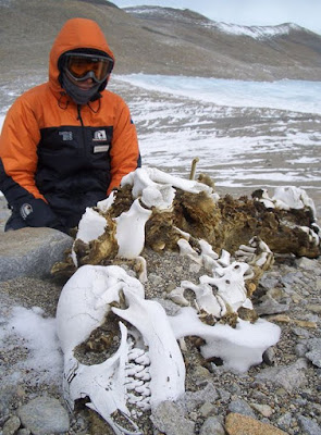
“It is worthy to record, too, that we have seen no living thing, not even a moss or a lichen; all that we did find, far inland amongst the moraine heaps, was the skeleton of a Weddell seal, and how that came there is beyond guessing. It is certainly a valley of the dead; even the great glacier which once pushed through it has withered away”
ASMA/ASPA map (Map from PGC) |
In environmental management speak 15000 square kilometres of the valleys have been protected as an Antarctic Speciality Managed Area (ASMA) since 1999. Within the ASMA, access is unrestricted as long as certain environmental protocols are followed. Secondary to this are ASPAs (Antarctic Specially Protected Areas) in which access permits must be applied for. On top of this there is also a limited number of designated tourists zones.
The concept of DryVER is to re-evaluate what human and climatic impacts are affecting the MDV now and in the future. Our aim is to "rewrite the book" on how we view significance and robustness at both the landscape and biological scale.
Its a big ask and so our team comes from a range of disciplines, institutions and countries. To tackle this we are broken up into four themes:
- Aquatic. Lead by Ian Hawes (UC). Studying the hydrological cycle within the valleys and the flora and fauna of the lakes and ponds.
- Climate. Lead by Peyman Zawar-Reza (UC), aims to produce wind models that will examine how material travels in, out and between the valleys.
- Terrestial Biology. Lead by Dr Lee, PhD (UoW). Looking at the modelled diversity of the biota in the valleys. This follows on the NZTABS project which we have been running in the valleys for the last few years.
- Impact. Lead by Prof Craig Cary (UoW). This is the team I am involved with. We are trying to understanding how camps and human movements in the field impact a range of surface (dunes, old lake beds, glacial sediments etc) and their rate of natural recovery.
The plan is that each theme will produce data that will go into a GIS model that can predict the effect that visitation will have on sensitive sites, the landscape and its biodiversity. It will also be able to predict the effects of climate change and susceptibility to invasive species.


